
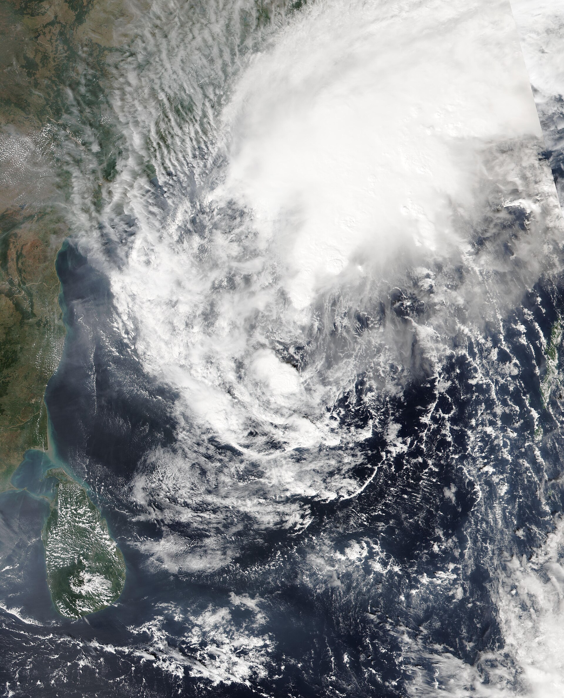
Cyclone Akvan began making landfall on India's east coast on Friday morning, crossing near the port town of Gopalpur in Odisha after weakening from a severe cyclonic storm — as nearly 300,000 people were moved to safety in one of the largest evacuations of the season.
The India Meteorological Department said the landfall process had begun along the north Andhra Pradesh and south Odisha coasts, with winds of 70 to 80 kilometres per hour and gusts of up to 90. No casualties had been reported by Friday morning, but officials warned that heavy rain and rough seas remained the main danger as the storm pushed inland.
“The landfall process has begun along the North Andhra Pradesh and South Odisha coasts near Gopalpur.”— India Meteorological Department, November 20 bulletin
The Details
The storm's centre was about 170 kilometres south of Gopalpur in the early hours of Friday, according to the weather department's bulletin, and it was expected to complete its crossing by late morning. The Bhubaneswar weather office confirmed that the system was coming ashore near Gopalpur, in Odisha's Ganjam district.
Akvan had lost strength before it reached land. It weakened from a severe cyclonic storm to a cyclonic storm, and the weather department expects it to fade to a deep depression by Friday evening and a well-marked low-pressure area by Saturday morning.
The bigger threat now is the rain. The weather department has warned of heavy to extremely heavy rain across coastal Odisha and northern Andhra Pradesh, with thundersqualls and rough seas, and rainfall is also expected in neighbouring states. Red warnings cover the coastal districts.
How We Got Here
Akvan began as a low-pressure area over the southeast Bay of Bengal on November 12, became a cyclonic storm on November 16 and strengthened into a severe cyclonic storm the next day. Its path kept shifting: the weather department first expected it to strike south-central Andhra Pradesh, then moved the forecast north until it settled on the coast between Narsapur and Puri, close to Gopalpur.
It is the third cyclone to threaten Odisha in 24 days, after Arnab and Murasu. The name Akvan was suggested by Iran under the regional naming system, the weather department's director general, Mrutyunjay Mohapatra, said.
A State on Alert
By Thursday evening, 298,676 people had been evacuated and moved to 2,523 relief camps, Special Relief Commissioner Rajesh P Patil said. The state had 9,341 cyclone shelters ready, and 423 rescue teams were deployed — including 60 teams from the Odisha Disaster Rapid Action Force, 14 from the National Disaster Response Force and 131 fire service teams. The Indian Coast Guard kept helicopters and vessels ready.
Chief Minister Mohan Charan Majhi chaired a midnight review meeting at the relief commissioner's office in Bhubaneswar. More than 4,170 pregnant women were moved to safe shelters, and 1,317 of them have given birth, he said.
Sixty-nine trains were cancelled — 41 by East Coast Railway, which also rescheduled 29 more, and at least 28 express trains by South Eastern Railway, mostly bound for or passing through the temple town of Puri. Tourists were barred from Gopalpur, Puri, Satapada and Chilika, and schools were shut across the coastal districts. The Gundicha Temple in Puri will stay closed from November 19 to 21, while the Jagannath Temple remains open.
Why It Matters
The evacuation is the story as much as the storm. Odisha has built one of the world's largest cyclone-shelter networks, and the speed of the evacuation, nearly 300,000 people moved before the storm arrived, is what stands between a weakening cyclone and a disaster.
The weakening itself is good news, but it is not the end of the danger. The impact is far from over: a cyclone that arrives weaker can still drown the districts it crosses, and the red warnings for rainfall remain in force even as the winds ease.
What Happens Next
Akvan is expected to weaken to a deep depression by Friday evening and a well-marked low-pressure area by Saturday morning. Rain will continue over Odisha and the neighbouring states through the weekend.
Authorities will begin assessing damage once the storm passes, and rail services are expected to resume as conditions clear. The next official update will show whether the evacuation — and the weakening — were enough to keep the casualty count at zero.




Loading comments…